

Location intelligence
or
spatial intelligence
, is the process of deriving meaningful insight from
geospatial data
relationships to solve a particular problem.
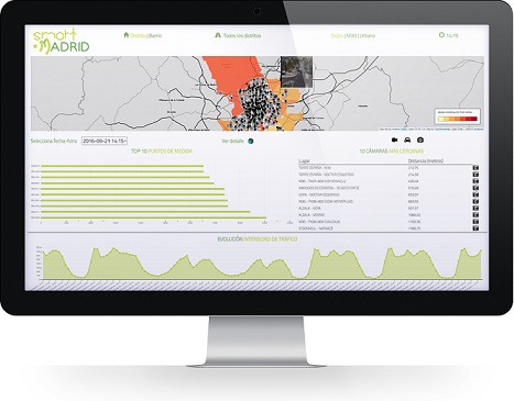
(Click on the above dashboard)
It involves layering multiple data sets spatially and/or chronologically, for easy reference on a map, and its applications span industries, categories and organizations It is generally agreed that more than 80% of all data has a location element to it and that location directly affects the kinds of insights that you might draw from many sets of information (Wikipedia rules)
Deploying location intelligence by analyzing data using a geographical information system (GIS) within business is becoming a critical core strategy for success in an increasingly competitive global economy.
Location intelligence is also used to describe
the integration of a geographical component into
business intelligence
processes and tools
, often incorporating
spatial database
and spatial
OLAP
tools
.
Check this
Online Dashboard
created by our friends from
Stratebi